How space-based monitoring supports resource management goals in Asia Pacific
Asia-Pacific governments are increasingly strengthening their commitment to responsible disaster and risk management.
In Japan and the Republic of Korea, there has been progress in corporate governance and emissions reporting. More countries in the region are adopting similar regulations as well.
For companies looking to expand to the Asia-Pacific markets, incorporating these factors into their bottom line is not optional anymore. The region’s high climate vulnerability drives this urgency, whilst vast and diverse forest landscapes adds a layer of challenge to national ministries and forest agencies to monitor, regulate, and verify disaster risk reports.
Governments often rely on ground and aerial surveys, satellite data, and older, non-digital archival records as their primary data sources. Whilst informative, these approaches frequently lack the speed and clarity needed to deliver timely, actionable insights for broader audiences.
Modernising forest monitoring tools is important for governments to protect natural resources and territories whilst supporting regional economic growth. Space-based monitoring is an emerging technology in this area. Planet, a global provider of satellite data and analytics, is helping governments improve climate compliance. With hundreds of satellites in orbit, Planet has the unique capability to deliver near-daily images of broad areas, capture high-resolution images of key locations, and a nine-year archival data of satellite images.
Strengthening Asia Pacific forest projects with high-resolution data
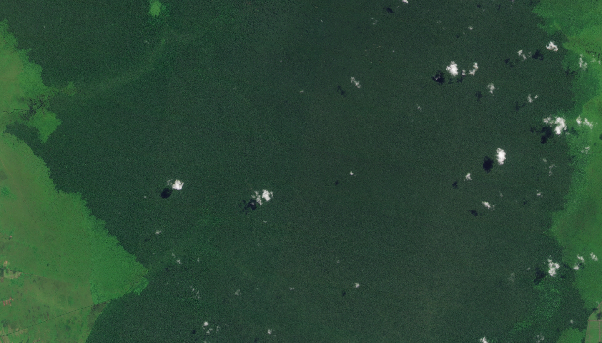
Planet image of Katingan Project, Central Kalimantan, Indonesia captured on July 21, 2022. © 2022, Planet Labs PBC. All Rights Reserved.
Across the region, mission-based local organisations are turning to Planet’s remote sensing technology to advance forest conservation and reduce carbon emissions. In Indonesia, a local initiative is projected to prevent emissions equivalent to 447 million tonnes of CO2 in a span of six decades.
In its early phase, the project used satellite data to map carbon plots, tree planting, and peat rewetting activities by community teams. However, they had limited access to high temporal resolution datasets from existing satellite providers. They needed to monitor changes in near–real time but cloud cover over their areas of interest made this difficult.
PlanetScope Monitoring™ and Planet Basemaps filled the critical data gap. PlanetScope Monitoring provides near-daily, 3.7-meter land imagery with easy access through a cloud-native platform, APIs, and GIS tools. It is scalable for a wide range of analysis and applications. On the other hand, Planet Basemaps produce high-resolution imagery into monthly, quarterly, and annual mosaics that support large-area change detection and machine learning analytics.
The combined Planet solutions allowed the team to detect small forest disturbances through frequent and detailed imagery. It enabled a more accurate tracking of the project’s carbon impact and strengthened their credibility at every stage. As of today, it stands as one of the largest forest-based emissions reductions in the world.
Planet data and analytics for transparent forest projects
Large-scale forest projects are happening across Asia Pacific, not just in Indonesia. Countries with complex landscapes and shifting policies are advancing forest conservation and carbon emission reduction initiatives, and satellite data and analytics can support them at every stage. Integrating space-based monitoring helps save resources, delivers reliable and timely datasets, and improves transparency.
The Planet advantage is the scalability of solutions that can be the trusted source of data for governments when verifying reports or for project managers consolidating fragmented datasets to create compliant reporting.
Explore how space-based monitoring can benefit forest project initiatives in Asia Pacific at every stage. Join the Planet APAC GeoGov Insights webinar in partnership with the Geo-Informatics and Space Technology Development Agency (GISTDA), “Turning Carbon into Capital: Advancing Disaster and Risk Management Goals through Space-Based Carbon Monitoring and Climate Compliance in Thailand”, or download the e-book, “Building Forest Resilience with Planet" for detailed forest management use cases leveraging satellite data and analytics.